Let’s face it – there are no real mountains in or even plausibly accessible as a realistic day trip from Berlin. But just because Berlin is lacking on the elevation front doesn’t mean there aren’t some really decent hikes (or walks…) in the German capital. With almost 20% of Berlin covered by forest and 7% water, there are plenty of scenic strolls on offer.
Along the Five Lakes of Grunewald
Overview
- Type: Point-to-point
- Length: 11 km
- Elevation gain: +50m
- Elevation loss: -60m
- Novelty factor: Endless swim spots
- Map Link: Komoot Map
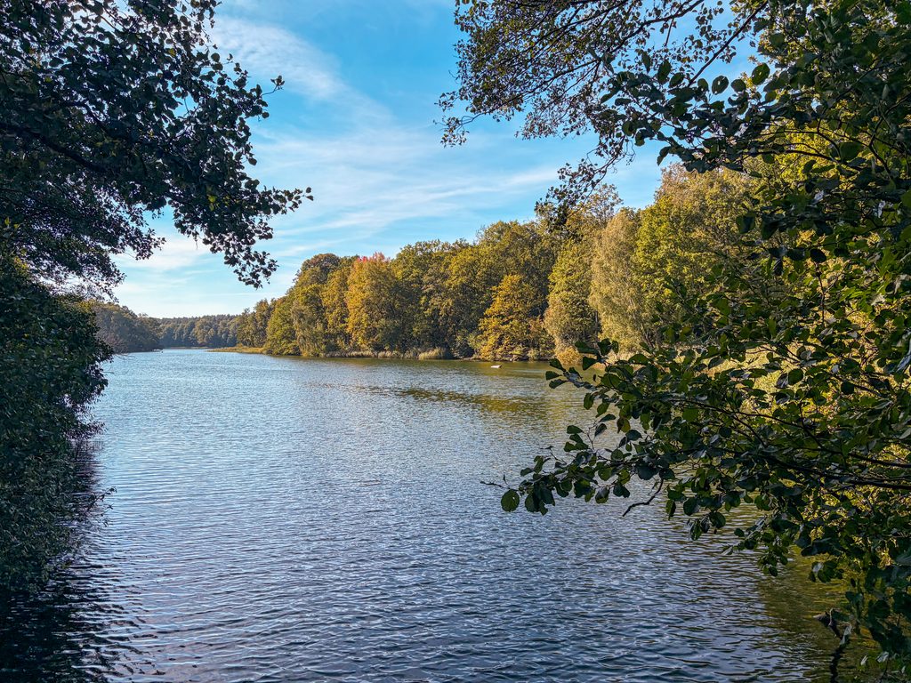
Perhaps one of my favourite go-to, year-round walks in Berlin is the route that takes you 11km along the shores of five lakes in a beautiful forest. In the summer, you can take a dip in the lakes. Schlachtensee is a local favourite for summertime swimming. Along the route you’ll pass a beergarden and restaurants you can pause at. There’s even an old hunting lodge along the route (Jagdschloss Grunewald) with a little cafe.
Both shores of the lakes have paths you can follow. If you stick to the south sides of the lakes you can access the detours and cafes more readily. Stick to the north sides if you want access to the more remote forest parts of the lakes.
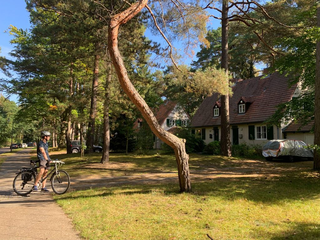
Optional Detour: Waldsiedlung Krumme Lanke
If you want to extend the hike and take a detour near Krumme Lanke, you can visit Waldsiedlung Krumme Lanke. This neighbourhood was built in the late 1930s for SS officers and their families. It’s interesting to see the old housing styles and neighbourhood design before the mass ownership of private automobiles.
How to Get There
The most straightforward way is to take the S-Bahn (S7) to S-Grunewald and return by the S7 at S-Nikolasee. Alternatively, you can do the whole thing in reverse.
Teufelsberg and Drachenberg – A Small Dose of Elevation
Overview
- Type: Point-to-point
- Length: 6 km
- Elevation gain: +90m
- Elevation loss: -80m
- Novelty factor: Views of Berlin and Cold War ruins
- Map Link: Komoot Map
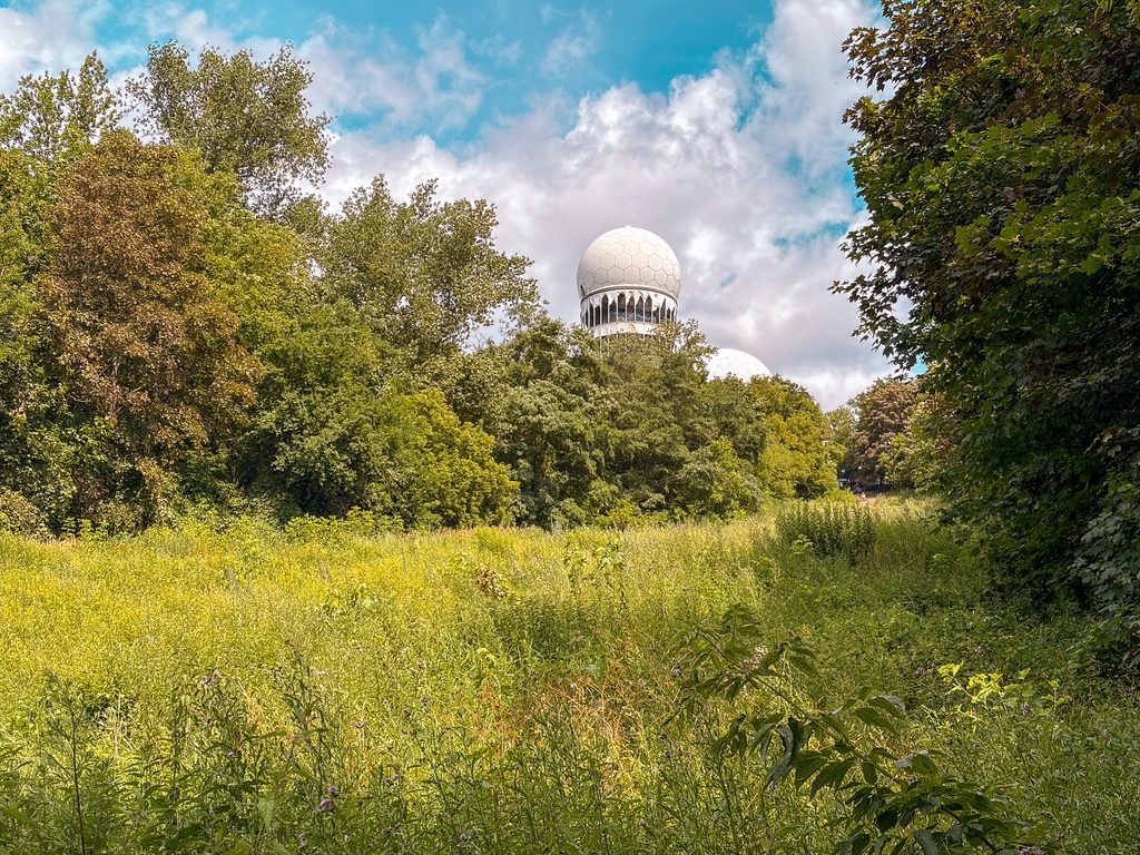
If you want a taste of elevation, Teufelsberg and Drachenberg are Berlin’s go-to hills. Both are artificial hills constructed from World War II rubble and debris. Soaring at 120m (Teufelsberg) and 99m (Drachenberg), these are hardly Alpine peaks, but still, it’s something – you can catch views of Berlin from the top.
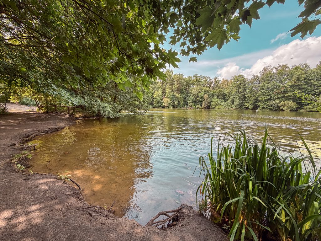
This hike starts at S Grunewald and ends at S Heerstraße, but you can also do it in reverse. From S Grunewald, you follow a well-visited forest path past a large sanddune and around the Teufelssee. You can stop to swim in this little lake in the summer. (Word of caution, it’s also popular with skinnydippers.) The route then goes up to the Teufelsberg where you can visit the former NSA listening tower (paid entry). There’s even a climbing wall nearby on an old rubble part that you can access (for free). The route then goes back down the hill and up Drachenberg. Drachenberg has a large meadow on top with unobstructed views of Berlin. It’s also pretty windy up there so it is popular with kite flyers. The route then goes back down the hill and through some woods to S Westend.
Optional Detour: Olympic Stadium
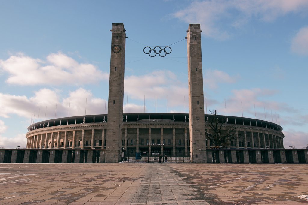
If you want to extend the hike, a nice detour is to continue beyond S Westend to the former Olympic stadium – the site of the 1936 Summer Olympics. Nearby is also the Unité d’Habitation of Berlin – a significant architectural high-rise apartment block designed by Le Corbusier (and extensively modified by Berlin housing regulations…). In summer, you can end your hike with a swim (paid entry, but really cheap) at the Olympic swimming pool.
How to Get There
Take the S-Bahn (S7) to S-Grunewald and return by the S3 or S9 at S-Heerstraße. Alternatively, you can do the whole thing in reverse.
From Waidmannslust to the Tegelersee
Overview
- Type: Point-to-point
- Length: 5.5 km
- Elevation gain: +20m
- Elevation loss: -30m
- Novelty factor: Waterbuffalo and swimspot
- Map Link: Komoot Map
The hightlight of this walk is definitely the field with the waterbuffalo. A close second is the abundance of ice cream options in Tegel at the end of the walk.
The walk starts off in Waidmannslust and follows a waterway through leafy neighbourhoods. The route winds past some swampy fields where you can catch a photo with the local waterbuffalo. It into Tegel, through a surprisingly decent newbuild neighbourhood abutting a waterfront area. It then follows the main road in Tegel where you have your pick of cafes and ice cream shops. You can then go down to the Greenwich Promenade which has a lovely view of the Tegelersee (lake).
Optional Extension: Moorland
Take the bus (806) to the church in Schildow to follow the Tegeler Fliess to add an additional 6km walk along a waterway and over boardwalks in Berlin’s moorland.
How to Get There
Take the S-Bahn (S1) to S-Waidmannslust and return by the U-Bahn (U9) which runs currently as a replacement bus from Alt-Tegel.
To Badestelle Kuhhorn on the Havel through Grunewald
Overview
- Type: Point-to-point
- Length: 13 km
- Elevation gain: +110m
- Elevation loss: -120m
- Novelty factor: Swimspot
- Map Link: Komoot Map
On a hot summer’s day, this walk brings you to a small beach on the Havel that is popular with locals. Since the walk is in the woods the whole time, shade options are ample.
It starts from S-Heerstraße passing through less-frequented parts of the forest before joining a wider path along the waterway. Eventually it comes to a small sandy beach area – Badestelle Kuhhorn – where you can set up for the day and enjoy a swim or a picnc. To head back, you’ll walk up the hillside (which is surprisingly steep) and along the road for a bit up until the Grunewald tower. There’s a relaxed restaurant here with beautiful views you can break at before heading through the woods towards S-Grunewald. On the way back, there is a water refill point by a small building in the woods (“Saubucht” on Google Maps) as well as a drop toilet.
How to Get There
Take the S-Bahn (S3 or S9) to S-Heerstraße and return by the S7 at S-Grunewald.
Highlights of Tiergarten
Overview
- Type: Point-to-point
- Length: 5 km
- Elevation gain: +10m
- Elevation loss: -10m
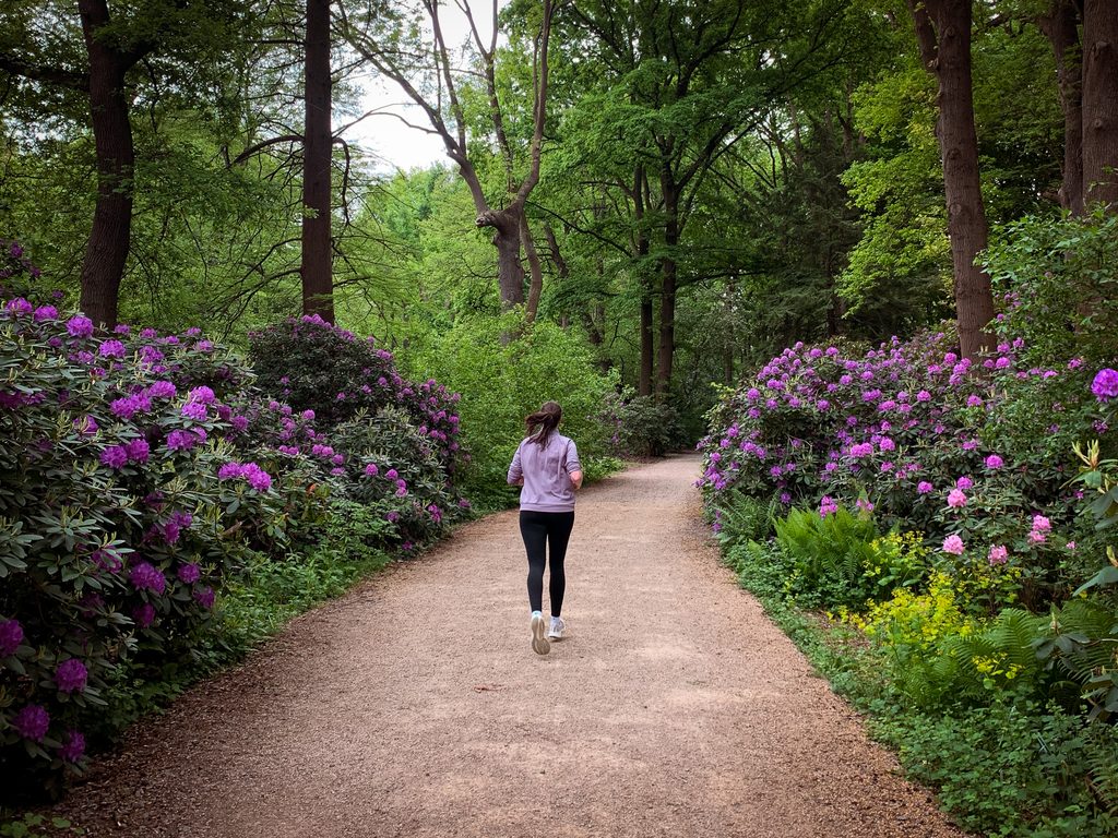
- Novelty factor: Nature in the city, Rhododendron in spring
- Map Link: Komoot Map
If you only have a short time in Berlin and want to get a walk in (or run), Tiergarten is a massive park in the heart of Berlin and very accessible from the central train station. Starting from the central train station, this route crosses the Spree river to give you a view of the Reichstag Building before crossing the road to go deeper into Tiergarten’s forests. If you’re lucky, you might even see some foxes along the way.
The path crosses the gardens on the Luiseninsel and follows a series of ponds along a path, that in late April and May is full of rhododendron, up to a rose garden. From here it goes around the Victory Column (Siegelsäule) which you can walk up (for a small entry fee) for views of the city.
The route then crosses the road to another quarter of the park to go along multiple small lakes. It then goes parallel to the rail tracks on a path lined with different historic lampposts from around Europe. It then crosses the waterway by a beergarden (worth a pitstop) to follow a path along the Berlin Zoo towards Zoologischer Garten where, if you’re lucky, you can catch a glimpse of a rhino through the fence.
Optional Detour: Holocaust Memorial
If you haven’t visited on a different occasion, the Memorial to the Murdered Jews of Europe is worth the detour. This 19,000-square-meter undulating field featuring 2,711 concrete slabs was designed by Peter Eisenman and includes an underground information centre.
How to Get There
Start from the Berlin Hauptbahnhof (central station) and return via the S3, S5, S7, or S9 from the Zoologischer Garten train station (three stops apart from each other).