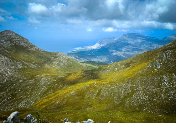
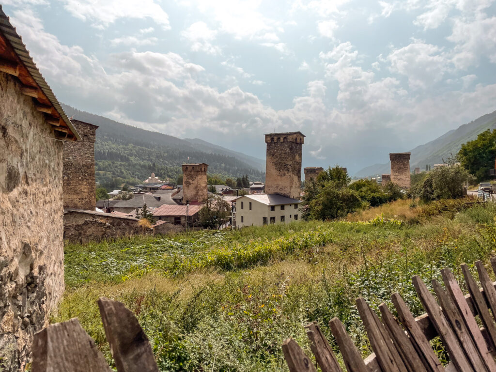
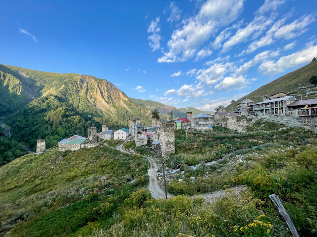
The Transcaucasian Trail (TCT) is a roughly 3,000 long-distance hiking trail crossing through Georgia, Armenia and Azerbaijan. The stretch from Mestia to Ushguli is perhaps one of the most popular sections of the route and with good reason – it’s graced with glaciers, views of stunning 5000m peaks, and villages home to charmingly old Svan towers.
But what many people don’t know is that you can actually start the trek 5 days earlier at Chuberi.
The section between Chuberi and Ushguli is one of the few sections formally completed along the total envisaged route. It takes about 7 to 9 days to complete (depending on how comfortable you want to take it).
Chuberi to Ushguli Hike Overview
- Location: Svaneti region in Georgia
- Length: 146 km
- Elevation gain: +9100m
- Time: 7 days
- Best time to go: June to September
- Sleeping: Camping mandatory on the first night, after that homestays/hotels are possible
- Start: Chuberi
- Finish: Ushguli
- Difficulty: Long days, but not technical
However having hiked from Chuberi to Ushguli, my advice is to skip the first three days of the hike and start from Etseri. It’s only from Etseri onwards where the trail gets interesting and you can leave the jeep tracks behind (for the most part). The first three days are much farther away from the hike peaks, and while don’t have as many hikers, can be quite tedious given the hours of jeep track you’ll find yourself on.
If you choose to hike the two days from Etseri to Mestia before continuing onto Ushguli, you’ll see far less people on the trails and still have epic views with a stunning high pass as the main event of each day. You will pass through and stay in villages with a lot less tourism as compared to later on in the route. Plus, when you do arrive in Mestia, you’ll look a lot more intense than all the other hikers.
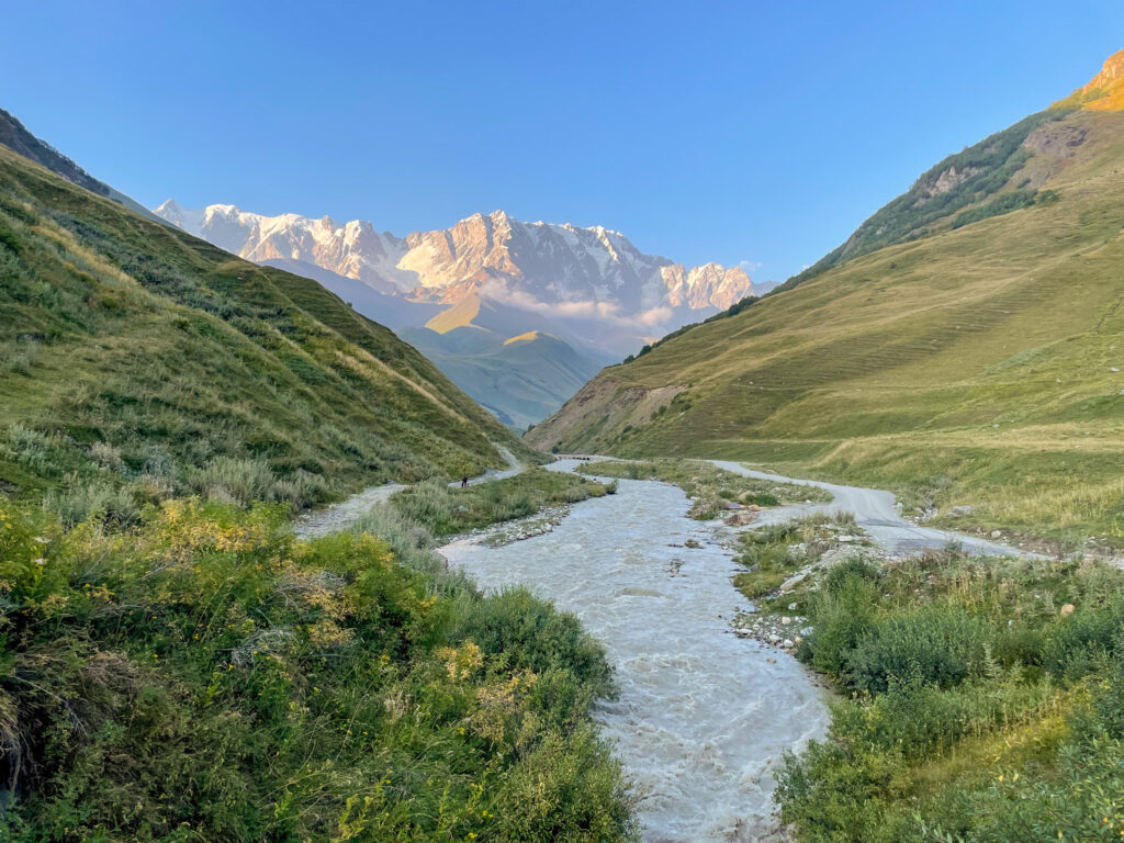
Day 1: Chuberi to Utviri Pass
Day 1 Overview
- Length: 19.5 km
- Elevation gain: +1960m
- Elevation loss: -170m
- Shade factor: Some and then none
- Water availability: Every few hours
- Map Link: Komoot Map
As hiking days go, this one was average. The last three hours were nice, but there’s a lot of drudergy you will need to put up with to get to that point.
To get to the trail start, you’ll need to get to the bridge crossing the river and take a left. The path follows up the mountain. It’s easy to quickly get lost, so keep an eye on the GPX track. You’ll cross a river just after you started walking uphill – there’s an obvious log across the river. Don’t use that. There’s a less obvious bridge hidden just downstream of the log. Use that. From there, you’ll need to bushwack your way up the hill a bit until you rejoin the trail. You’ll likely have to cross a few more small streams until you get comfortably back on the back.
The day the continues with a three hour or so steady meander along a ho-hum jeep track and up a pine forest before you finally reach a grassy field above the treeline.
From your exit from the treeline, the jeep track heads down towards a stream. We stopped here for a lunch break and refilled our water bottles. Definitely get water here because the water refill spots are very far and few as you keep going (we only found one reliable source closer to the pass, about three hours away).
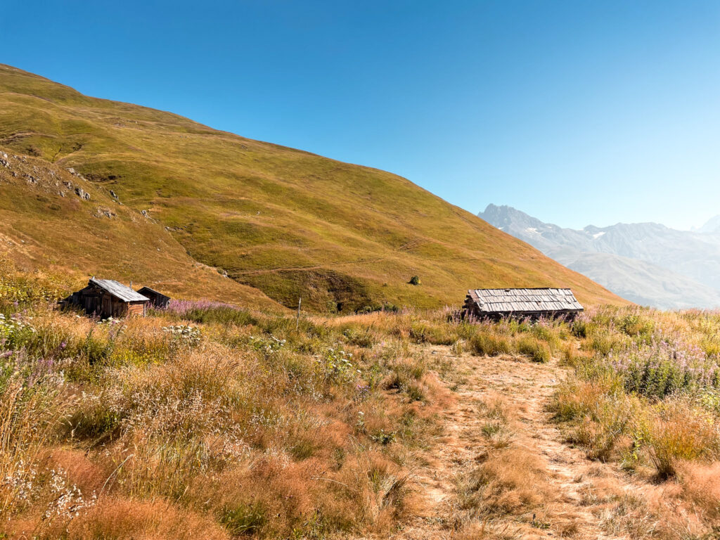
The path heads up the stream before it turns to the left up the hillside, past old abandoned farm huts and up higher and higher still until you finally have the pass in sight. You should at one point be able to see into the valley on your left – there are a few farm houses down there. Once you get up to the pass you can see your choice of campsites for the night (unless you chose to stop at the flat spot about half a kilometre before the pass).
Where to Stay Overnight in Utviri Pass
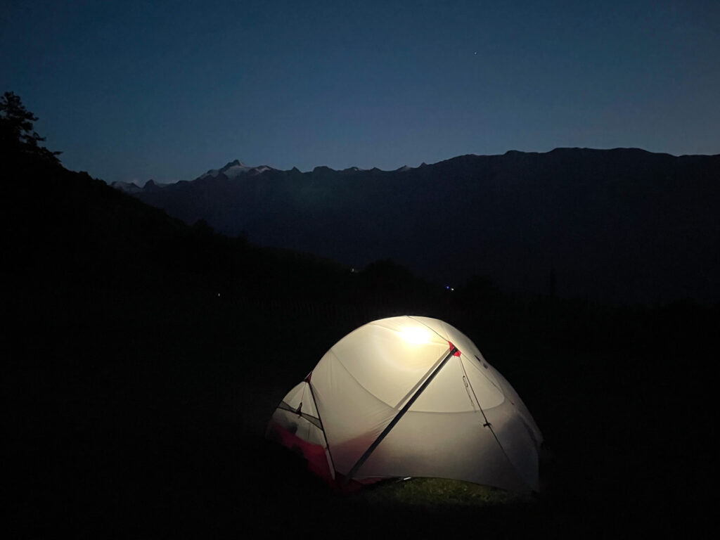
If you made it to the pass at the end of the day, you only have two choices: camp before the pass or camp after the pass. There are no homestays up here. We refilled our water (4 litres) at a stream shortly before crossing the pass and set up camp at the lake. The lake was easy to reach – we followed a path to the right from the pass that diverged from the main one and this brought us easily to the lake.
The lake was warm enough to swim in which was a bonus of that informal campsite. The downside was the millions of massive crickets and locusts everywhere. Also at night, in contrast to the day, it is absolutely dead quiet. If you live in a city with noise, like us, this can be extremely unsettling.
Day 2: Utviri Pass to Nakra
Day 2 Overview
- Length: 13 km
- Elevation gain: +30m
- Elevation loss: -1420m
- Shade factor: Second half is shaded
- Water availability: Regular springs and streams
- Map Link: Komoot Map
This was by far my least favourite day of the hike. It was almost entirely jeep track, recently mulled by construction vehicles. The pretty bit, above the treeline in the grassy dip of the pass, lasted for only a fraction of the day compared to the long slog of the jeep track.
For this reason alone, I would strongly recommend skipping the first two days entirely. Is it nice to camp at a pass with a view of mountains? Yes. Is it lifechanging? Not really. There are nicer hikes you can do with better views if you really want to sleep in a tent (for example, Kyrgyzstan).
Even just writing about this day makes me sad about a waste of what could have been a beautiful day. So let me keep it short.
From the camp spot, rejoin the path (very easy to cross the ravine/stream) and then follow it down to the jeep track after about a kilometre or so. Now follow the jeep track in mind-numbing agony through the logging woods until you get to Nakra.
Where to Stay Overnight in Nakra
We stayed in Green House Nakra which was great value (64 GEL – cash only) – it was clean and comfortable. The walls are thin, but if the other guests are hikers, everyone knows the drill – don’t be inconsiderate. There are two showers and two toilets shared amongst four double rooms (a luxury in these parts). We ordered dinner which was massive, but on the pricier end (roughly €30) given what it was (potatoes, beans, bread, salad).
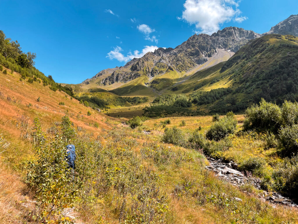
Day 3: Nakra to Etseri
Day 3 Overview
- Length: 26 km
- Elevation gain: +1450m
- Elevation loss: -980m
- Shade factor: Intermittent
- Water availability: Abundant water at taps in villages and from the streams
- Map Link: Komoot Map
I was really excited about this day after the last two, but alas, it also was almost all jeep track especially in the second half of the day. I expected more inhabited villages and bread-buying opportunities, but neither happened. In fact, there was no bread to buy along the way, so I’m not really sure what other bloggers are whimsically referring to.
The day starts off following the trail (badly marked) across the river and steeply up through the woods. It went past an upper part of the Nakra village where, for the first and only time on the hike, we encountered defensive dogs. (But it really wasn’t a big deal – their owners were right there.) The path eventually met up with a path that opened onto a series of fields. About 6km into the hike, there were a few (seemingly empty) buildings around and a picnic bench by the ruins of a building. Keep an eye on your digital maps for this part of the day – there are a lot of paths so it’s easy to lose yours.
From here, the trail then followed a jeep track towards Tsaleri, passing a few interesting buildings, and then turned downhill on a hiking path through trees and over a bridge at a stream (about 10km in). The path got a little weird here, following a lot of rocks until we passed over what must have been an old landslide. Eventually we got to Kichkhuldashi which was a series of empty buildings, for the most part.
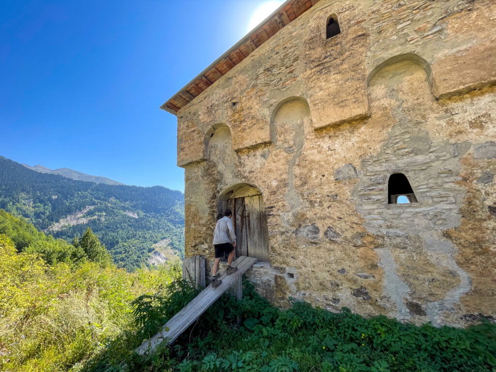
From here, the jeep track again met a path downhill through trees to a stream where there was a bridge. This then followed uphill to another small village, Gheshderi. From here we walked along a jeep track in horrible sun and heat for a long time before we finally got to Village Pari. There are a few guesthouses here you can stay in at this point.
But we continued along the jeep track until eventually a path cut away from it to the right down the hill. This crossed a stream and then we had a long hike up the hill before we rejoined the road at a village. This road eventually turned to concrete as we walked into Etseri (the last part felt like forever).
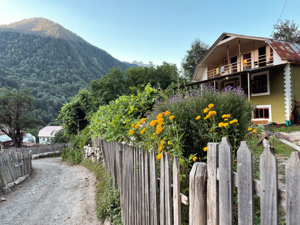
Where to Stay Overnight in Etseri
There are multiple basic guesthouses. We ended up camping on the field that belonged to one of the families from Gujejiani Guest House. We paid 40 GEL (cash) to camp in a field which is about the same as overnight indoor accommodation, so in hindsight, it really didn’t make sense. We only camped to justify carrying the tent along this trek.
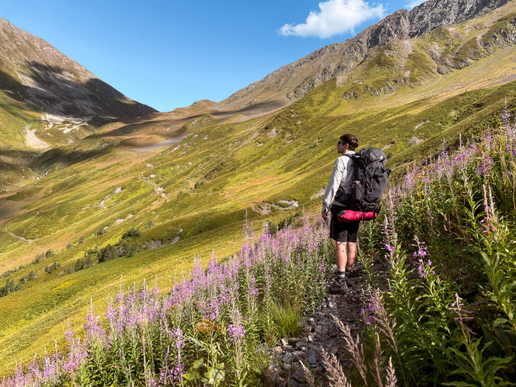
Day 4: Etseri to Mazeri
Day 4 Overview
- Length: 14 km
- Elevation gain: +810m
- Elevation loss: -900m
- Shade factor: Second half is shaded
- Water availability: Very limited
- Map Link: Komoot Map
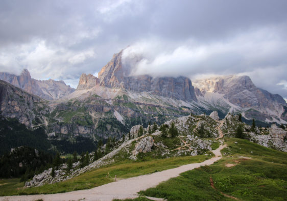
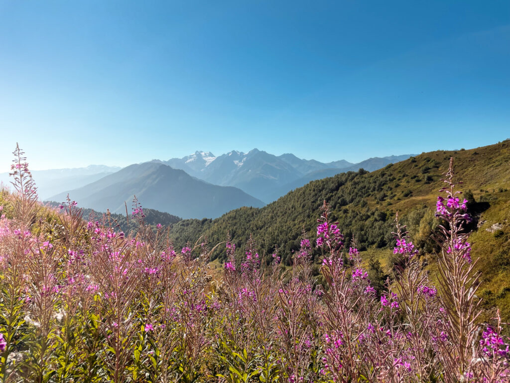
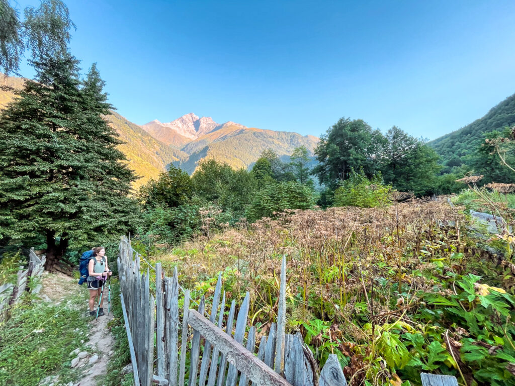
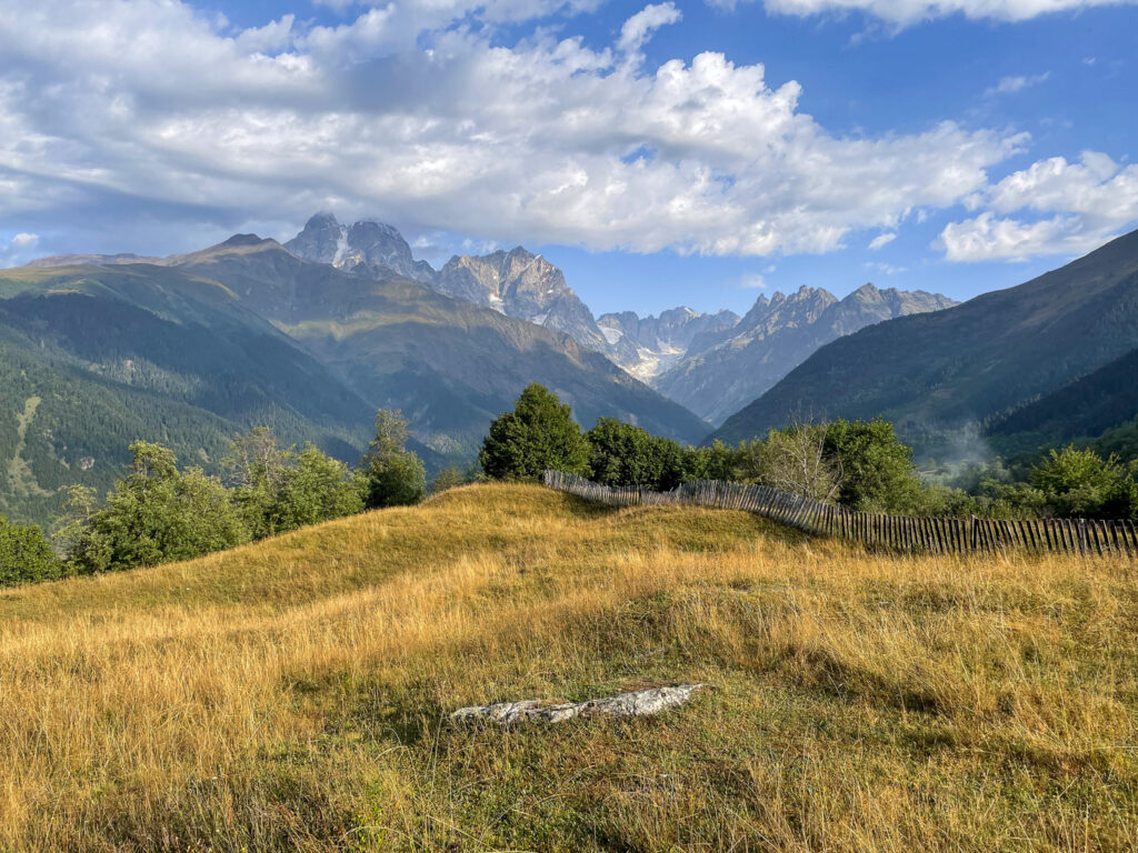
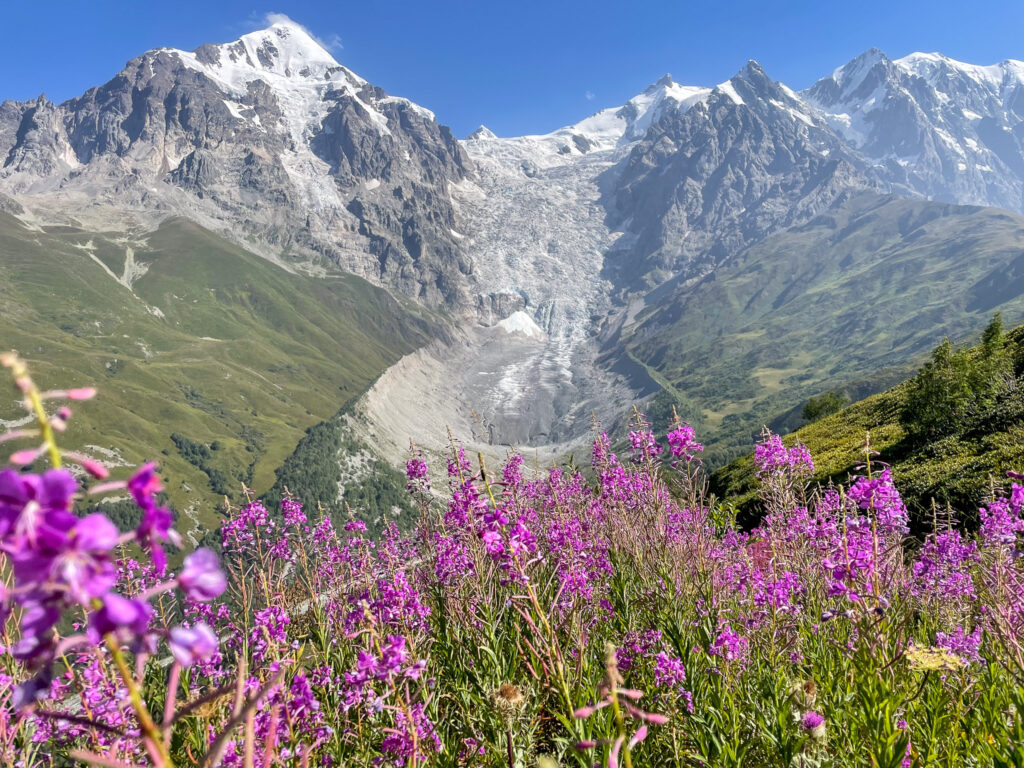
From today forward, the hike finally gets interesting. The trail gets much closer to the hike peaks and the views become increasingly dramatic.
We started the day super early to maximise our chances of seeing the fabled Mt Ushba from the pass we needed to climb. We set off just after 7am and followed the jeep track around the valley. Eventually it came to an empty cafe and the jeep track fizzled out into a trail. The trail wound through a LOT of giant hogweed. We touched a bunch of it but luckily nothing happened to our skin.
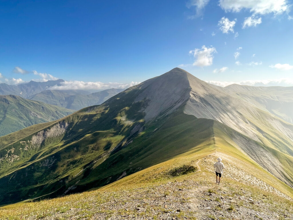
The trail then zig-zagged up to the pass. We hung around up here for an hour hoping the clouds would clear and we’d get a view. But we weren’t lucky. So we decided to follow a trail to our right along the ridgeline, instead of the official trail down to Mazeri. This took us through some flowering bush and towards a small chapel on a hill and a lake (Lake Mesiri) below. We stopped here to cook up some soup to go with the bread we finally managed to hunt down in Etseri. From here the trail goes town into the pine forest and follows a pretty steep zig-zag dirt path until it connects with a jeep track. The track connects you to a trail that then goes very very steeply down a grassy field and another field into Mazeri. You should end up on a road which will take you to a bridge you’ll cross to get into the village proper. There’s a mineral spring at the bridge if you want to try it – it tasted a bit rusty to us. On the way into Mazeri, you’ll pass Ellie’s Cafe (accepts card) which is a great option for dinner or a drink if you need.
Where to Stay Overnight in Mazeri
I can’t recommend the place we stayed (cleanliness was lacking), but others stayed in Guest House Waterfall and seemed happy enough. We walked past the Cottages SHIKHRA which seemed nice as well. Overall, the guesthouses are extremely basic here. You can only pay in cash.
If you are carrying a tent, I’d recommend rather carrying on and following Day 5’s trail up into the bottom of the pass. There is a flat area there between two rivers on raised ground with very nice views on a clear day.
Day 5: Mazeri to Mestia
Day 5 Overview
- Length: 20 km
- Elevation gain: +1380m
- Elevation loss: -1620m
- Shade factor: Very limited
- Water availability: Limited
- Map Link: Komoot Map
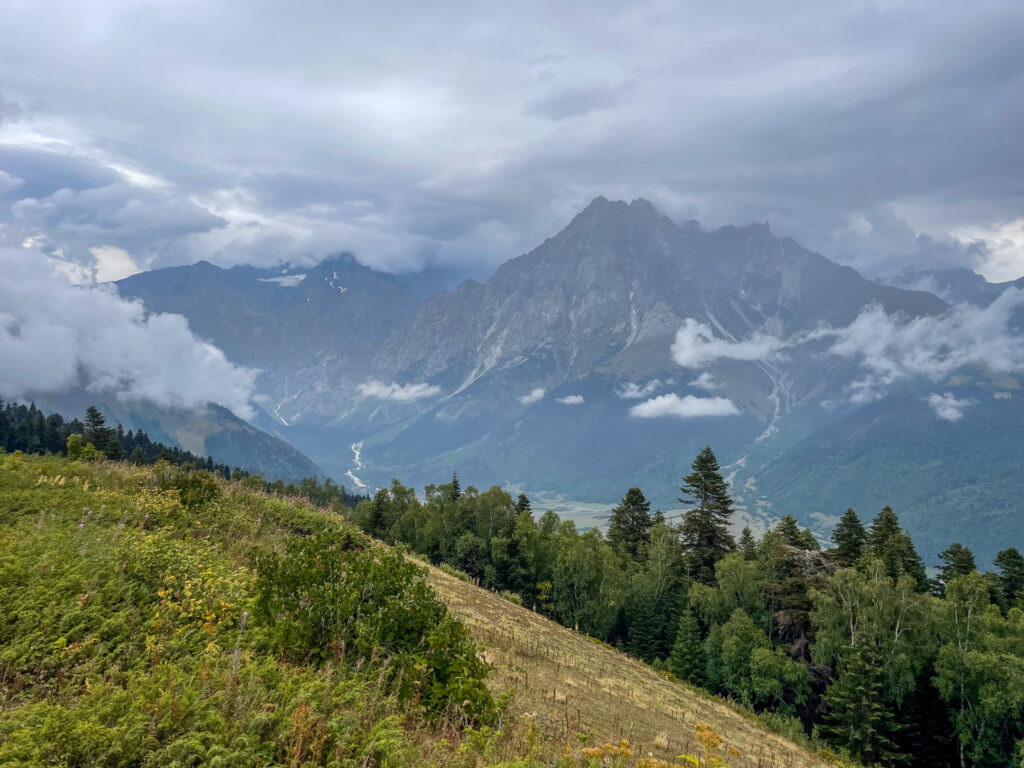
Sadly, we missed this day. It was going to be one of the most beautiful passes we would cross and would have brought us right up to Mt Ushba. We did set off and hiked about 3km into the trail for the day, but turned back when it started raining heavily and thundering. It turned out the weather forecast was going to be correct for the day and it wasn’t going to be just a light drizzle. While it would have been okay to hike the pass, there wasn’t much point because the views were completely obscured. So we took a taxi for 100 GEL to Mestia (we got overcharged for sure).
We did return, however, to hike part of this route after completing the full trek and so we can comment a little on what the day looks like.
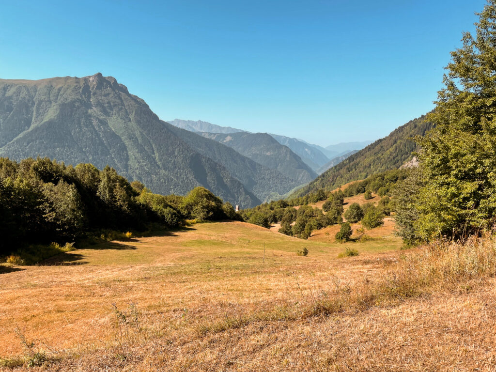
If you do get lucky with the weather, the first half of the day is dedicated to a steep ascent up the valley and the pass. Up there you, should have great views of Mt Ushba. The trail will then go steeply down the other side before it flattens out as you join a jeep track. Unfortunately, there are a lot of cars driving up this track to visit Koruldi Lakes. You can also take a detour to these lakes (requires some uphill) but given what you’ll have seen on the trail, the lakes are a let down in comparison. (They are also more like stagnant water ponds.)
This jeep track will then take you down towards Mestia. It goes past a cafe where you can get a cold drink. From the cafe, you can either follow the jeep track the whole way to Mestia, or split off and follow a hiking track steeply (but relatively safely) down the mountain for about an hour or two (depending how much you let gravity take you).
Where to Stay Overnight in Mestia
There are tons of decent options in Mestia. We stayed in Mestia Panorama (cash only) and absolutely loved it. Rooms are sound-proofed and modern, but well-designed. We had a view of the river and the town at night which was beautiful. There’s a well-equipped kitchen you can use to cook in. The owners speak great English and are lovely and so accommodating. We checked in quite early on two occasions and they were able to let us into our room early. We were also able to leave a bunch of stuff behind while we did the next stretch of the hike to Ushguli.
Day 6: Mestia to Adishi
Day 6 Overview
- Length: 27.5 km
- Elevation gain: +1740m
- Elevation loss: -1090m
- Shade factor: Limited forest cover
- Water availability: Limited (some streams after the halfway mark, otherwise cafes in villages)
- Map Link: Komoot Map
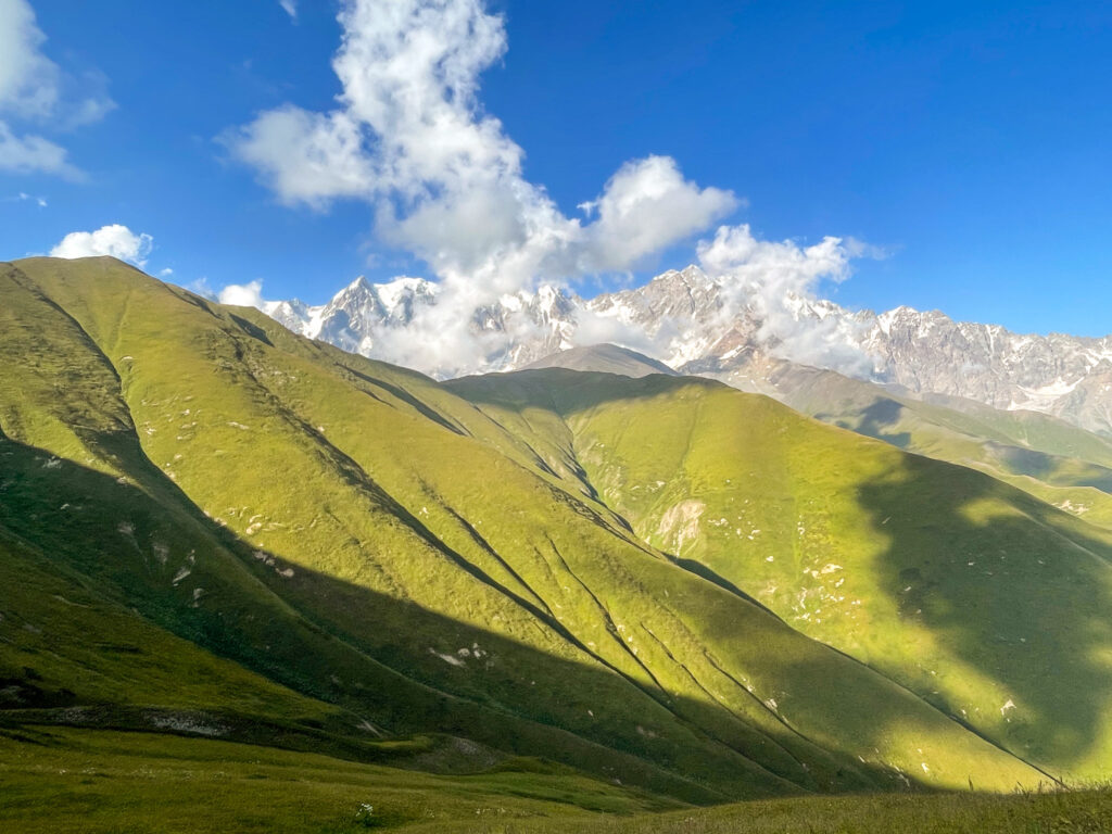
In a nutshell, we combined two days of the traditional route into one day. Read my post on hiking from Mestia to Ushguli for the full description of this day. The first half of the day’s hike is relatively flat passing through villages along a round. The second half is the interesting part – we took the high route which brings you above the tree line and lets you descend into Adishi with the sunset.
Where to Stay Overnight in Adishi
We stayed in Vista Adishi (cash only) which was completed about a month before we stayed. It was okay, but there were likely better options (we booked the night before).
Day 7: Adishi to Ushguli
Day 7
- Length: 24 km
- Elevation gain: +1680m
- Elevation loss: -1600m
- Shade factor: None
- Water availability: Limited (some glacial rivers after the halfway mark)
- Map Link: Komoot Map
For a detailed account of this day, read my post on hiking from Mestia to Ushguli for the full description. Again, we combined two days into one day and completely skipped Ipari to avoid the final 10km of the trail that takes you on a boring road. The day starts off following a flat jeep track along the Adishischala river for 5 km before you get to the infamous river crossing. Cross this – by horse or on foot. We went on foot.
After the crossing, you’ll follow a trail uphill to a pass where you can take a brief detour to a higher viewpoint. From the pass, we followed the trail down the other side until we go to the river in the valley. We crossed the river using a wooden bridge.
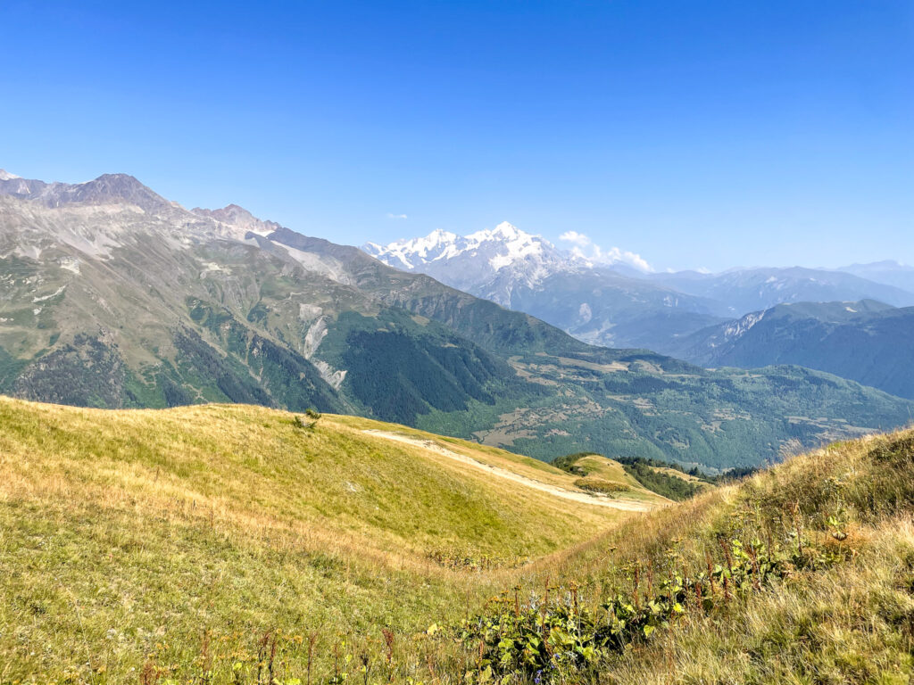
And then we followed a pretty overgrown, unmarked trail up towards a second, even higher pass – Lagem Pass. Though we were absolutely drenched in sweat and super tired, taking the route to this pass was well worth it. The views were even better than at the first pass. You get excellent views of Khalde Wall – the natural mountainous border between Georgia and Russia.
Where to Stay Overnight in Ushguli
We stayed at Gamarjoba Guest and Art House (cash only) which was pleasant – it even has an art gallery.
Getting back from Ushguli to Mestia
The only way to get back to Mestia from Ushguli is by private or shared taxi. Unfortunately, there are no marshrutkas (minibus taxis) that service this route. The drive back to Mestia takes under an hour.
A private taxi transfer costs 200 GEL (as of 2025), which given the distance is completely overpriced. A shared taxi, where the taxi waits for multiple people, is 50 GEL per person. The shared taxi generally would leave around mid-morning from the central bus station near Ushguli Guest House Buba. I would confirm with your guesthouse in Ushguli what the best way is to get back to Mestia.
The best thing to do is to speak to other guests at your guesthouse or hikers you meet along the way to Ushguli to agree to split a taxi. There were 6 of us at our guesthouse who wanted to split a taxi and we managed to haggle the price down to 40 GEL per person.
Getting to the Hike Start
You can either aim to get directly to the hike start in Chuberi (or any of the other villages on Days 3, 4, or 5 as you prefer)
Or you can first get to Mestia and then arrange a transfer or take a marshrutka back towards the hike start on the next day. You just would need to hop of the marshrutka at the entrance of a valley you want to start your hike from and walk up the road a bit to get to the official trail. The advantage of this is you can get gas in Mestia and you can leave a few of your things at a hotel in Mestia (like clean clothes and a resupply of Clif bars).
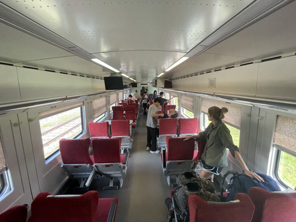
By Train
If you want to get to Chuberi directly, the best way to get there is to take a train to Zugdidi and then arrange a private transfer via Facebook or GoTrip. We paid 170 GEL for a transfer from Zugdidi to our accommodation in Chuberi.
You can book tickets for the train via the official website.
The direct train to Zugdidi departs daily from Tbilisi at 8:20 in the morning and from Kutaisi Airport at 12:50 (note: this station is a 20 minute drive outside of Kutaisi). The train arrives in Zugdidi at 15:08. From there, it’s about another 3 hours drive by marshrutka to Mestia. The train from Kutaisi Airport costs 13 GEL per person in second class (which is completely fine) or 25 GEL per person in first class (a bit more spacious). From Tbilisi, a second class ticket is 17 GEL and a first class ticket is 29 GEL. The onward marshrutka to Mestia costs 35 GEL per person (cash).
The other way is to take a taxi from the train station in Zugdidi towards Mestia and then hop off just after the road crosses the bridge over the rapids to the right towards Mestia. You would then need to walk about 8km and hopefully find someone to give you a lift.
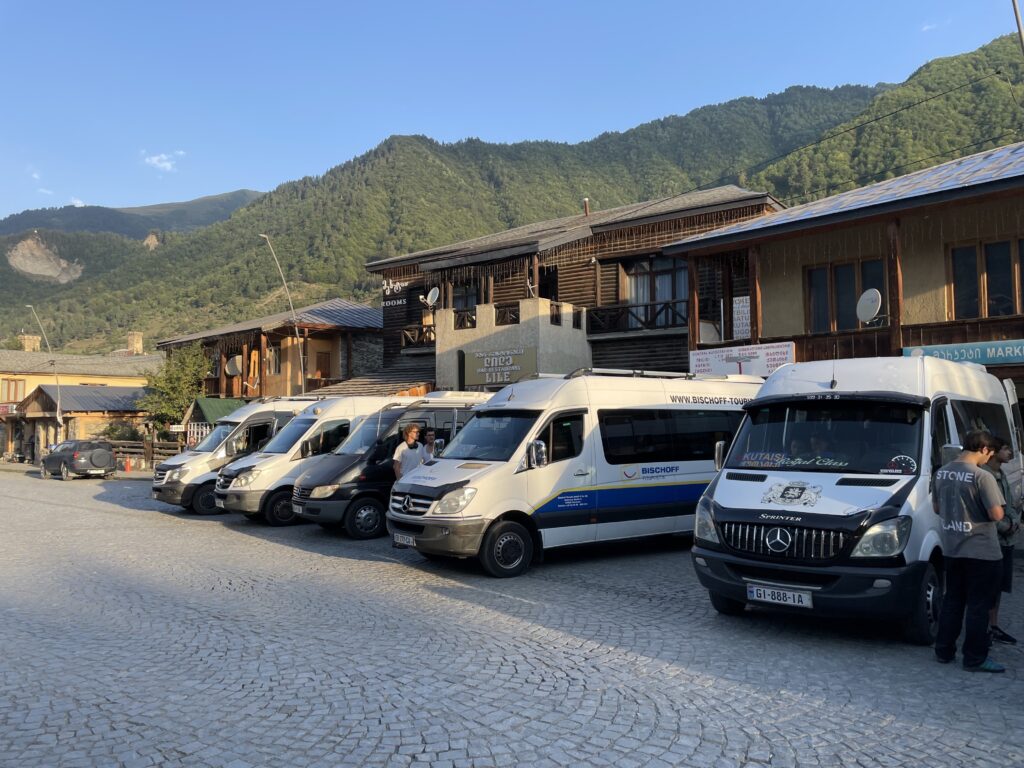
By Marshrutka
Alternatively, you can take a marshrutka from any major cities directly towards Mestia. However, that can be less comfortable, given the long distances. From Kutaisi the journey to Mestia is about 5 hours and from Tblisi the journey is about 9 hours. From Kutaisi, you can take a marshrutka for 40 GEL per person, and from Tbilisi it is 50 GEL per person.
The marshrutka leaves from Tbilisi at 7:00 in the morning from Tbilisi’s Navtlugi Bus Station. The direct marshrutka leaves from Kutaisi at 10:00 from the Central Bus Station (near the edge of the city, by the McDonald’s).
To leave Mestia, marshrutkas depart from the Central Bus Station in Mestia at 8:00 to all destinations. The Google Maps location for the station is here.
By Plane
Probably the most direct, but least sustainable, way you can get to Mestia is by flight with Vanilla Sky. There are daily flights from Tbilisi for 90 GEL and twice a week from Kutaisi for 50 GEL. However, there is a max baggage allowance of 15kg per person. And if the weather conditions are bad (which is not unheard of in the mountians), your flight may be cancelled. You’re likely better off sticking with the train and marshrutka options.
What to Pack
We packed basically the same items as we did for Kyrgyzstan except this time we didn’t take gloves and we reduced the number of spare clothes we brought. Overall, this worked for us. You can check out the packing list here.
Foodwise, we carried four dinners with us (ramen noodles and vegan dehydrated soy strips), homemade bags of oats (with peanut butter powder, raisins, and cinnamon), Clif bars, chocolate bars, and other assorted snacks. We definitely did not have enough calories in our bags to survive without restocking along the way.
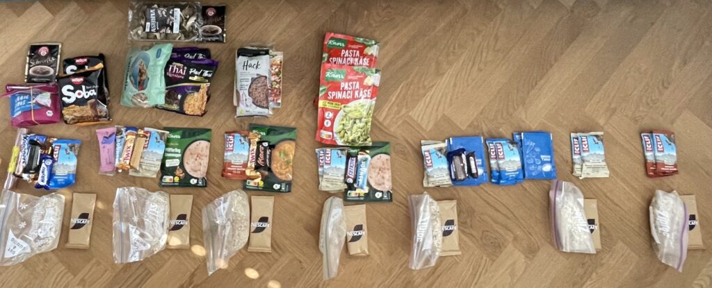
One of the best things we did do was we had Knorr soup packets with us which we boiled up at lunch and ate with bread we’d buy at the guesthouses in the evenings.
Camping gas we bought in Kutaisi. We were able to purchase this from the bus counter in the Kutaisi airport. However, if you plan to start your hike in Mestia, you can easily buy gas in most souvenir shops there.