If you’re looking for a multi-day trek in Georgia, you’ve probably heard of the classically popular Mestia to Ushguli hike. It’s famous for a good reason. It passes through numerous traditional Svan villages, swings by centuries-old towers, and brings you within hearing distance of massive glaciers (yes, glaciers make sounds!). Most people would hike this over 3 to 4 days, with about half a day of hiking each day.
What you probably didn’t know is that it’s perfectly hikeable in two days. If you are reasonably fit and have confidently walked these distances and elevations before, you can do this 2-day version. There are also a few tweaks the routes to avoid crowds and bring you much closer to the high peaks.
Mestia to Ushguli Hike Overview
- Location: Svan Region in northwestern Georgia
- Length: 52 km
- Elevation gain: +3420m
- Elevation loss: -2690m
- Time: 2 days (no breaks), or 3 days taking the variant stop in Tsvirmi (but normally 4 days)
- Best time to go: mid-June to mid-September
- Sleeping: Camping or Homestays
- Closest city: Mestia
- Start: Mestia
- Finish: Ushguli
- Difficulty: Long days, but not technical
Day 1: Mestia to Adishi
Day 1: Mestia to Adishi
- Length: 27.5 km
- Elevation gain: +1740m
- Elevation loss: -1090m
- Time: 10-12 hours (no breaks)
- Shade factor: Limited forest cover
- Water availability: Limited (some streams after the halfway mark, otherwise cafes in villages)
- Map Link: Komoot Map
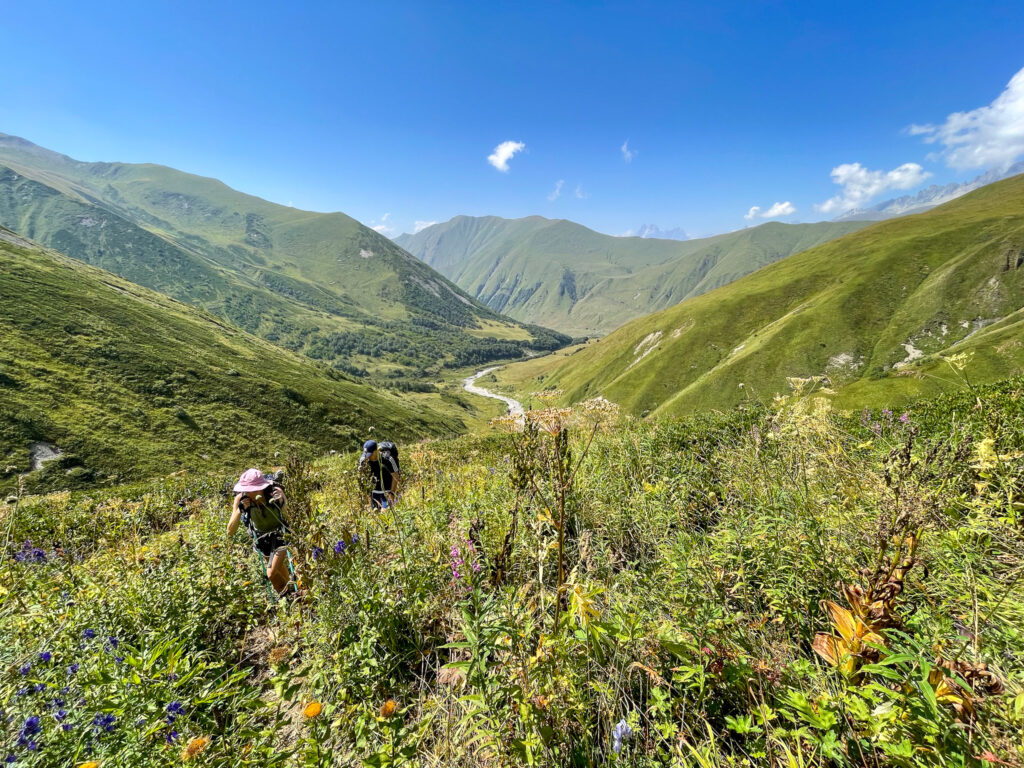
The first day combines days 1 and 2 of the traditional Mestia-Ushguli route, passing by Zhabeshi rather than stopping there.
The first hour of the hike follows a jeep track through the trees north out of Mestia, with 500m of gradual elevation gain to a small pass at about 1900m. If you’re late enough in the morning, there’s a cafe serving coffee here that may be open. At this point there are decent views of Mt Ushba to the west. You can see the villages stretching out along the road you’re about to follow to the east.
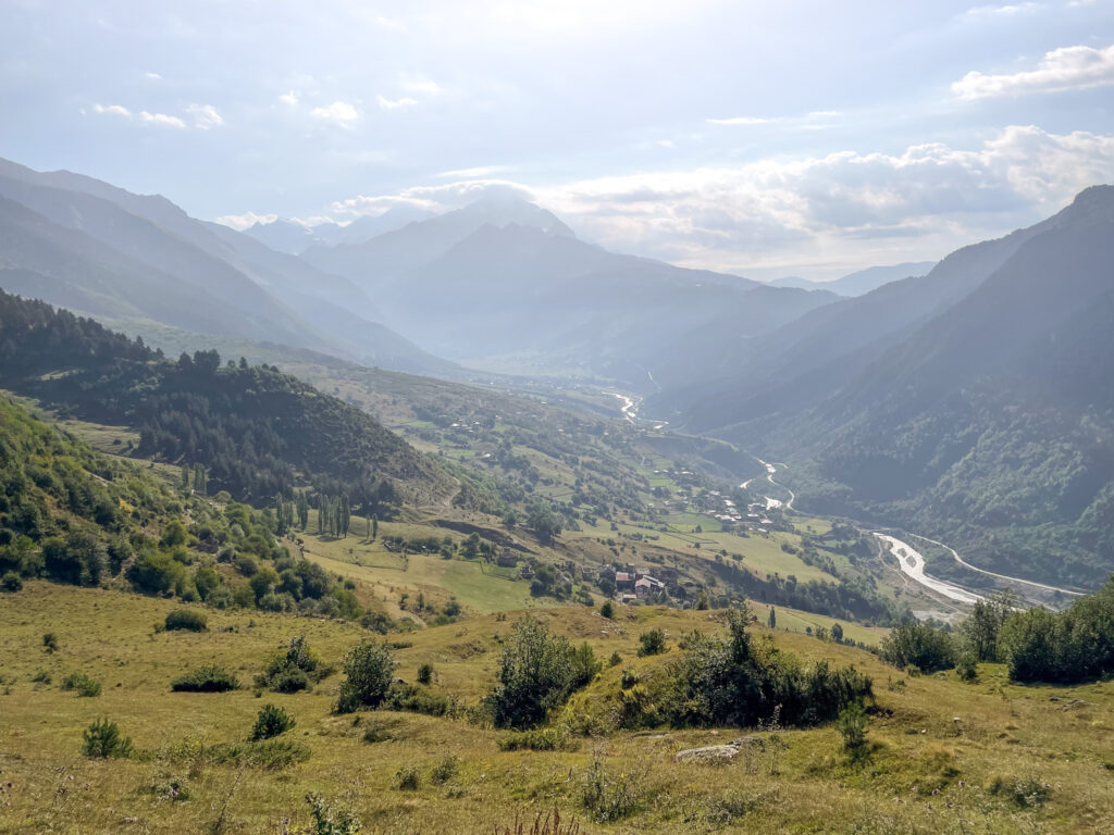
The road passing through the villages meanders downhill and levels out for the next few kilometres. It’s generally quite dull. If you have the time, it is nicer to take the alternative route via Tsvirmi detailed later on. There are several home-run cafes and many abandoned buildings along the way.
As you come to the river where there is a bridge for cars, you’ll see a sign pointing to your left through a rocky area to the left of the river. Take this trail and continue along the river. Pay attention to the signs and you will eventually after a few kilometres find a pedestrian bridge (also used by cows) that you can take to cross the river.
Follow the path on the other side directly up towards the village Chvabiani. Walk through towards the Orthodox church on the hill. If you’re almost out of water, make sure to buy some in this village before you continue. We couldn’t find any reliable water sources in late August after this point until much farther into the hike.
After the church (watch out for the aggressive dog nearby – it’s on a line, but still…), you’ll continue upwards until you enter a forest path. (There’s a nice camping spot up this way if you wanted to stop for the day.) Follow this path upwards and you’ll eventually get to a ski lift. There’s a cafe here as well if you are in desperate need of a cold drink. It’s triple the price of restuarant pricing, but worth it after that slog.
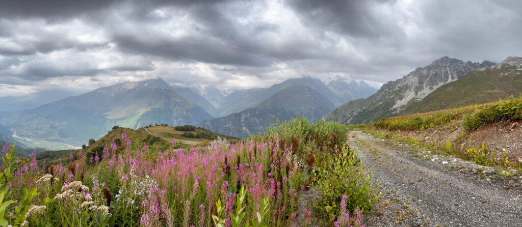
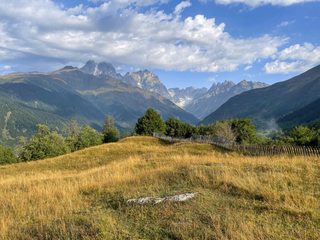
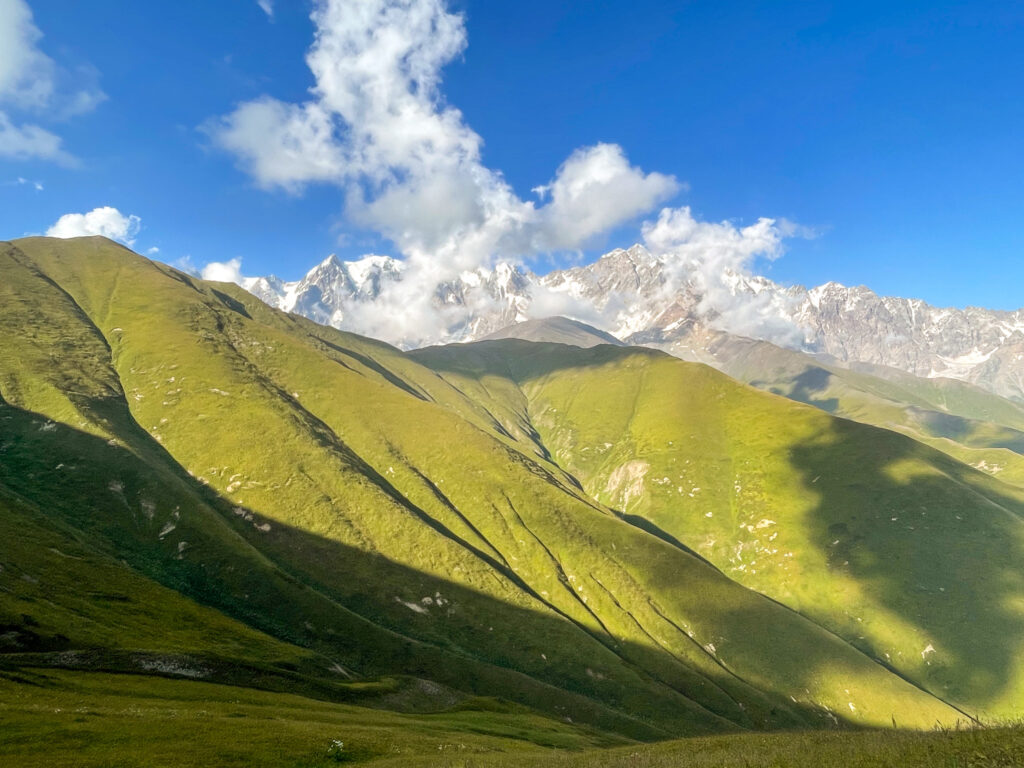
From here things get interesting again. Instead of following the trail to the right from the ski lift down the pass (i.e. the traditional route), you’ll continue to follow the jeep track up the mountainside towards the main ski buildings (Tetnuldi Ski Resort). You’ll then see a sign to your right, just before you get to the buildings. This will take you off the jeep track and onto a trail through the grassy slopes. If you are here on a clear day, you will have fab views of Mt Tetnuldi and the surrounding mountains.
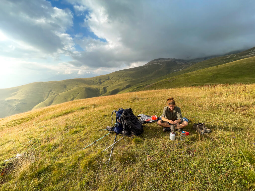
You’ll continue to follow this trail that is relatively flat and then will go downhill. It is a bit overgrown at points but not impossible to follow. At this point in the day, you’re likely to hit golden hour so your photographs should be amazing. We paused up here at around 2500m to make dinner before we continued on to Adishi.
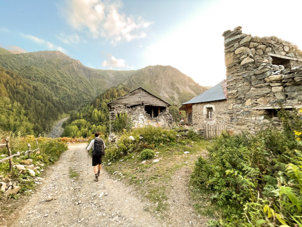
Finally, you’ll come down a very steep hillside towards a makeshift cafe. Follow the trail to your left into Adishi. Adishi itself is bizarre. It’s beautiful from above, but once you’re in it, it is a conglomeration of ruins and recently built guesthouses with people shouting from hidden corners if you’d like a room.
Where to Stay Overnight in Adishi
We had no trouble booking a room the night before setting off during high season (late August). We stayed in Vista Adishi which was completed about a month before we stayed. It was clean, but otherwise likely not any better than the other options in the village. If you don’t book ahead, that’s fine. There seem to be plenty of options in the village where you can get a room on arrival (though you might have less choice in terms of quality).
Alternatively, if you want to camp, there are a few flat options outside of Adishi, if you continue along the official trail alongside the river for about 800 metres or so. We saw a couple camping near a tower which looked like a nice spot with views of the mountain.
Day 2: Adishi to Ushguli
Day 2: Adishi to Ushguli
- Length: 24 km
- Elevation gain: +1680m
- Elevation loss: -1600m
- Time: 10-12 hours (no breaks)
- Shade factor: None
- Water availability: Limited (some glacial rivers after the halfway mark)
- Map Link: Komoot Map
The second day follows day 3 of the traditional Mestia-Ushguli route and completely bypasses day 4 of the traditional route – i.e. the infamously boring-as-heck road section.
Start this day as early as possible because you’re going to need the whole day. It’s technically more challenging than the first and it has a lot more photo stops.
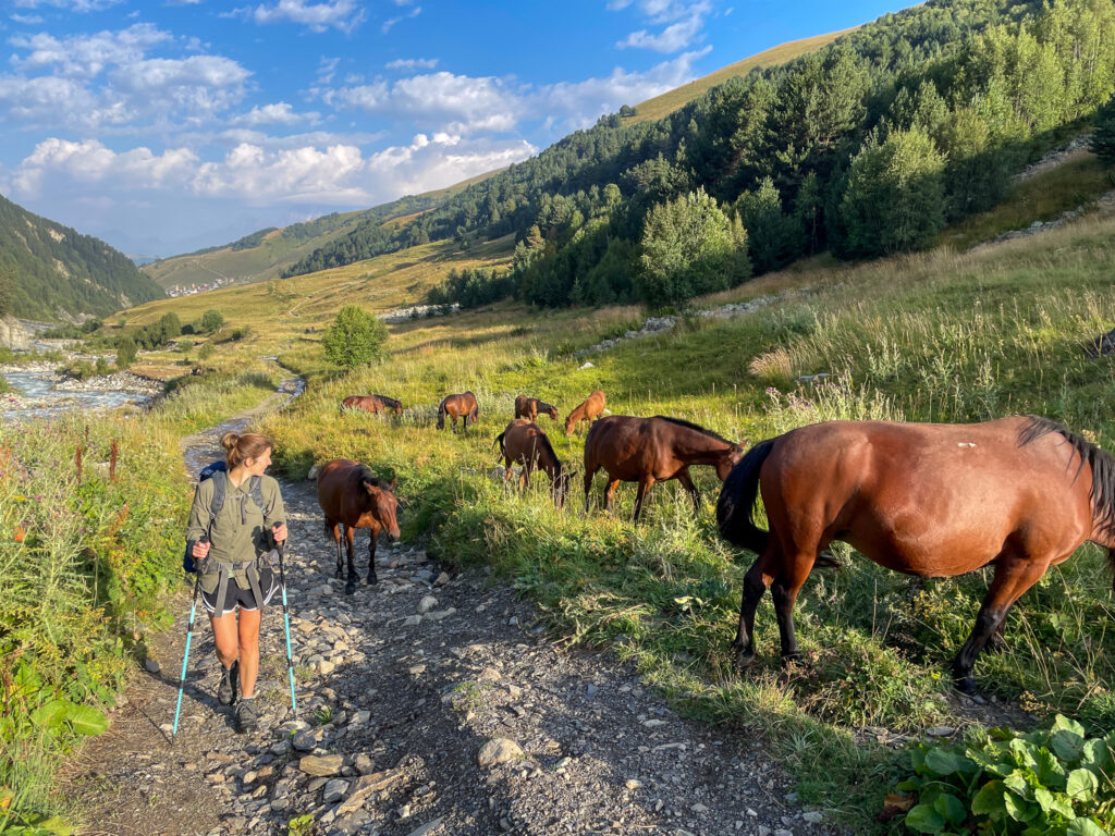
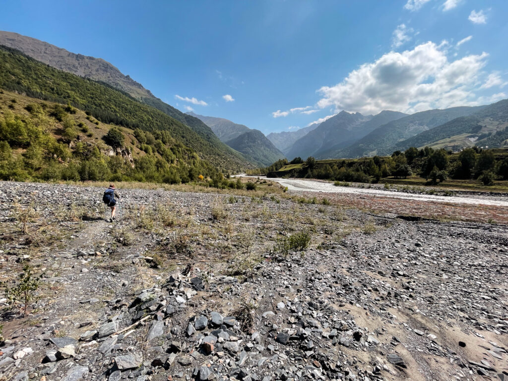
The day starts off following a flat jeep track along the Adishischala river for 5 km before you get to the infamous river crossing. You’ll probably notice the air has gotten colder from the nearby glacier. If the water levels look high or you don’t trust yourself, you can pay 25 GEL to have a horse take you across. Otherwise, with some sandals, hiking poles (or a sturdy stick), and a friend, you can attempt to cross the river. Look for a wide, braided section where the water spreads out shallowly, avoiding narrow, fast-moving channels. We ended up in a fast-moving channel and I was up to my thighs in strong currents. I needed help to keep from getting swept downstream.
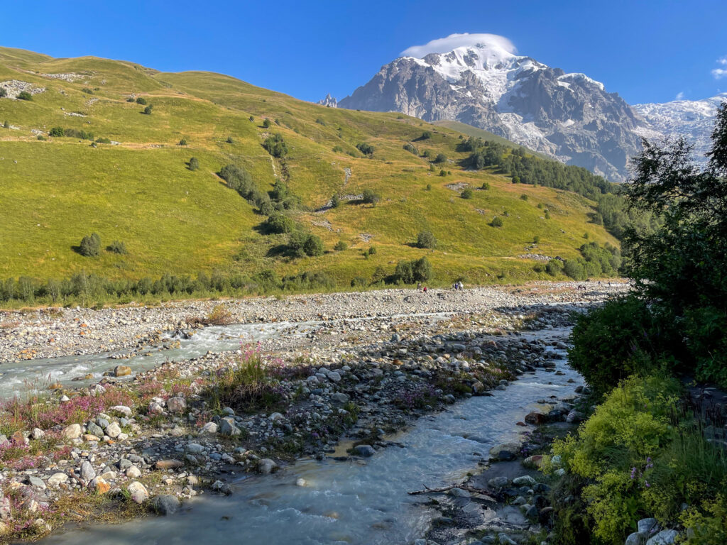
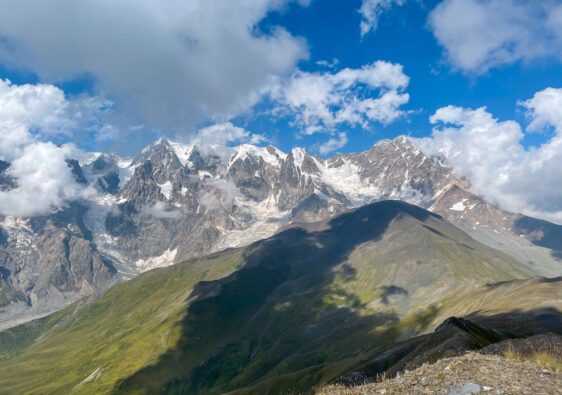
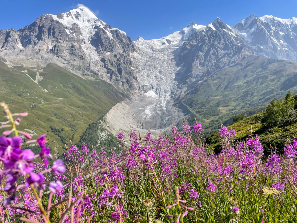
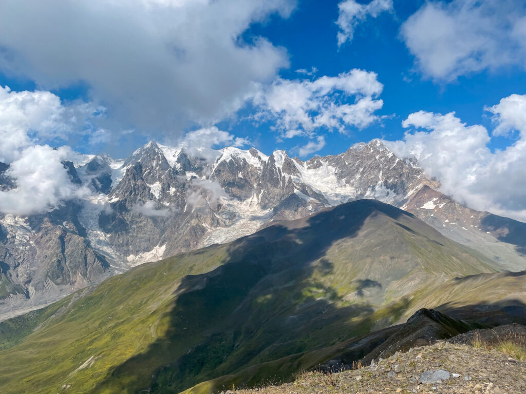
After your refreshing crossing, you’ll head along the trail into the forest. The trail will now become quite steep for the next 2 km. There are plenty of spots to pause and take photos of the glacier as you head up to the Chkhutnieri Pass (2700m). If you’re here in the morning you can even hear the glacier – it sounds like a rumbling thunder.
At the pass, you can take a route to the left by the Tibetan prayer flags to continue even higher up the pass to get even better photos of the glacier.
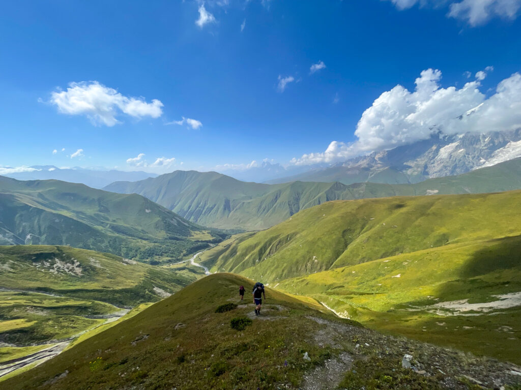
To continue, you’ll follow the trail down along the grassy pass until you meet a trail at the bottom of the valley. This is the point where you will say goodbye to most hikers for the day since they’ll be continuing on to the right to Ipari.
However, if it is already after 13:00, you should consider if you really can finish this hike today. There is no accommodation along the route from this point. So if you don’t think you’ll make it to Ushguli before nightfall, head to Ipari and attempt this part of the route tomorrow.
You’ll turn right at this intersection of trails and walk for a few metres. Then you will follow an unmarked trail into the overgrown trail to your right. (Follow the maps link on your phone very carefully to avoid missing the trail!) This will take you to the river where you will find a bridge to cross. If there is no bridge, do not cross this river! It looks extremely dangerous.
From the bridge you will follow an overgrown trail that will lead you past a stream. This is a great point to refill your bottle. You’ll want at least 1 litre per person, if not more, since the water options from here on are limited to non-existent.
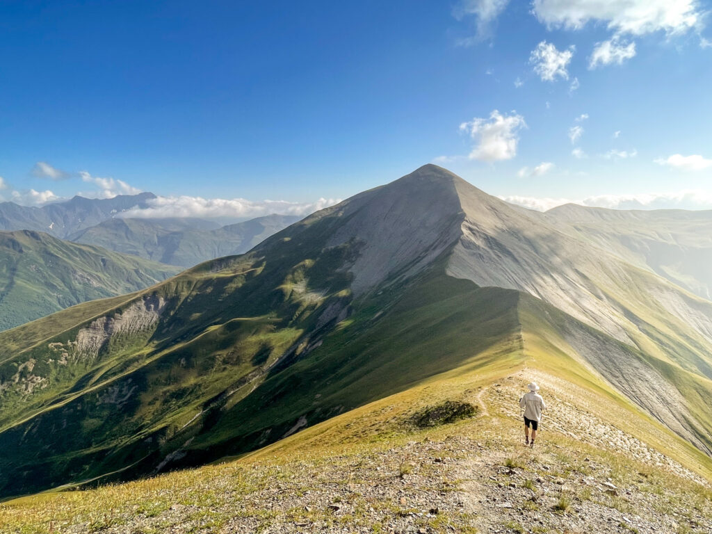
The trail will exit the overgrown bush after a while and you’ll cross a rocky ravine (not technical to cross). Look out for the cairns to find the trail. Once you’ve crossed, following the trail up to your next pass to 2900m is relatively easy in terms of wayfinding, but physically exhausting. There is absolutely no shade here. However, if it were raining, I would not recommend this route due to how steep and potentially slippery it is.
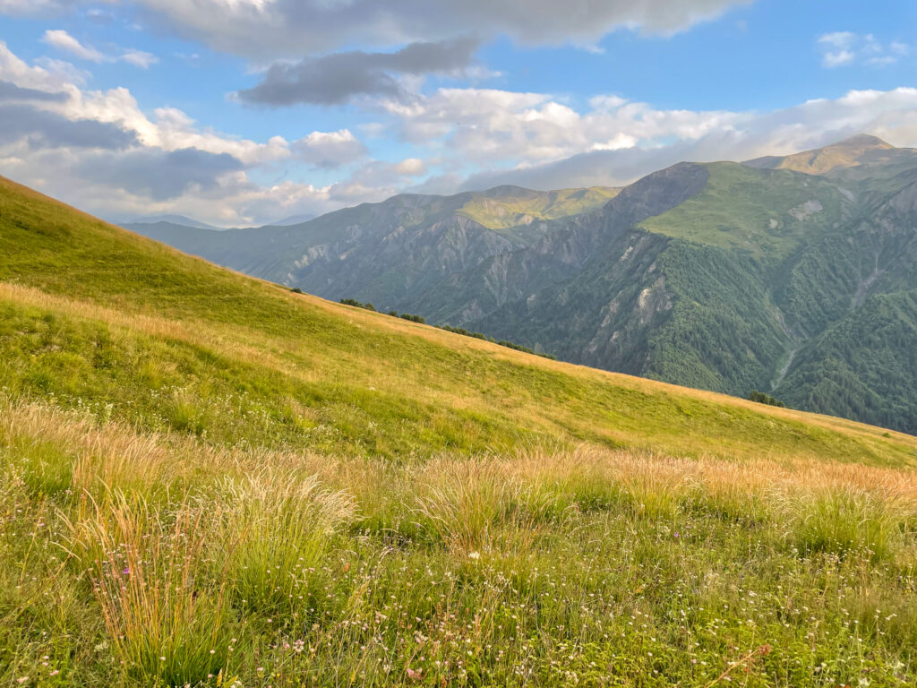
Once up on the pass, you can continue another 1 km on the pass to get higher to 3120m and get even closer to the high peaks and the glaciers. At this point, the afternoon light should be absolutely glowing on the peaks. If you are lucky, you should have good views of Mt Shkhara (Georgia’s highest peak). On a clear day you can see Mt Elbrus in Russia (Europe’s highest peak).
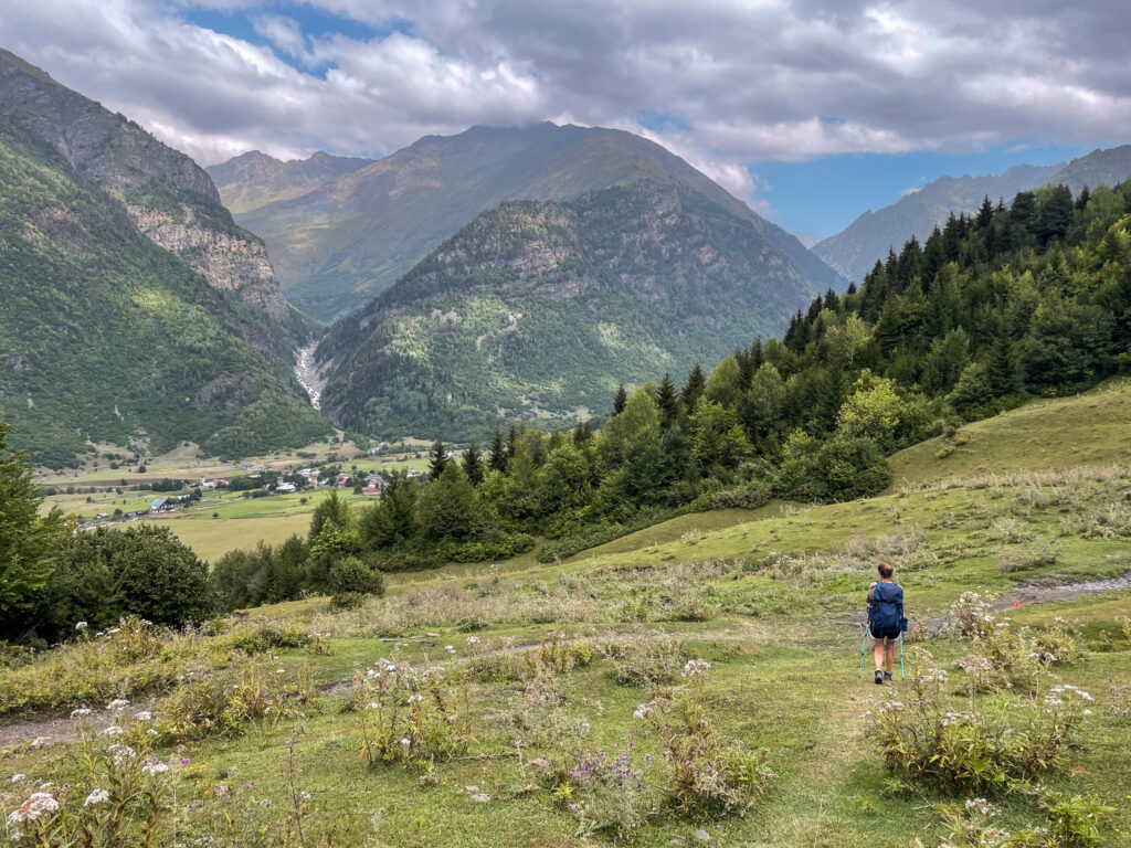
To get to Ushguli, you’ll follow the trail down the pass (should be relatively easy to locate). It meaders through meadows on the mountainside and at times is quite overgrown with rhododendron but is never impossible to find or follow. At it wraps around the curve of the mountain, there will be a few options to refill your water bottle if you need (about 1-2 hours from the top of the pass).
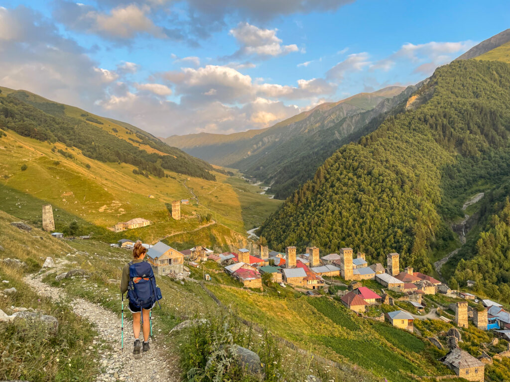
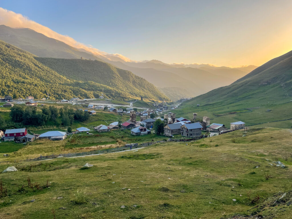
The path eventually joins a gravel road for the last couple of kilometres and brings you into Ushguli (likely in time for sunset).
Where to Stay Overnight in Ushguli
You’ll likely get in quite late and want to spend the night in Ushguli so you can meander around the UNESCO village in the morning.
Again, we had no trouble booking a room the just before setting off on this trek during high season (late August). There were plenty of options available. We stayed at Gamarjoba Guest and Art House which was fine – it even has an art gallery. If you do choose to stay here and want dinner when you arrive, let the guesthouse know before noon or the day before, if possible. We only wrote to them at 3pm the day of arrival which was too late.
There are plenty of camping options on the outskirts of Ushguli as you approach the village. We saw numerous camping cars parked on plateaus with epic views of the peaks.
3-Day Variant
If you have time to hike the route from Mestia to Ushguli over 3 days and want to break up the long first day, you can alternatively do the following:
- Day 1: Mestia to Tsvirmi (16.6 km and 1,150m elevation gain)
- Day 2: Tsvirmi to Adishi (18.3 km and 1,520m elevation gain)
- Day 3: Adishi to Ushguli (follow the Day 2 Adishi to Ushguli route)
The benefit of the 3-day variant is that you can skip the road on the first half of Day 1’s route and head up along a ridge with a view of the high peaks. Word also is that Tsvirmi is a nice village to stay in overnight. Day 2 of this variant follows the high route from the ski resort as previously described. If you’re exceptionally fit, you may be able to smash Day 1 and Day 2 together.
Getting back from Ushguli to Mestia
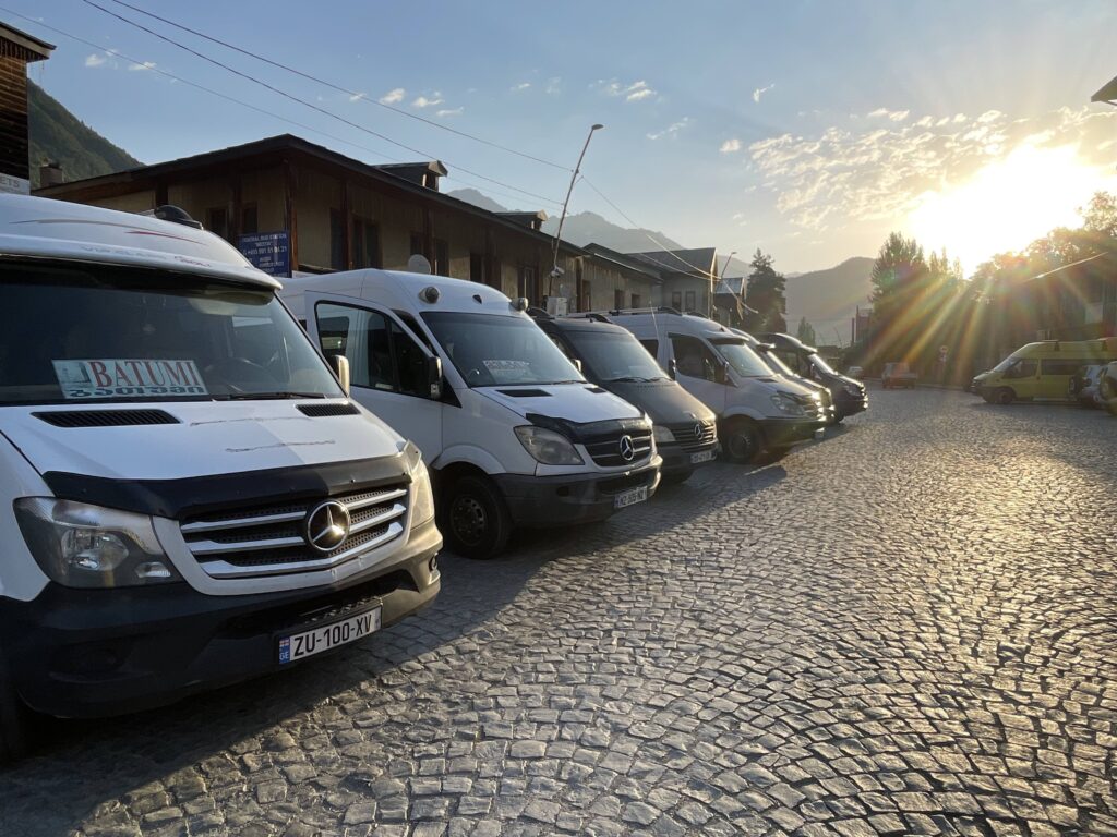
The only way to get back to Mestia from Ushguli is by private or shared taxi. Unfortunately, there are no marshrutkas (minibus taxis) that service this route. The drive back to Mestia takes under an hour.
A private taxi transfer costs 200 GEL (as of 2025), which given the distance is completely overpriced. A shared taxi, where the taxi waits for multiple people, is 50 GEL per person. The shared taxi generally would leave around mid-morning from the central bus station near Ushguli Guest House Buba. I would confirm with your guesthouse in Ushguli what the best way is to get back to Mestia.
The best thing to do is to speak to other guests at your guesthouse or hikers you meet along the way to Ushguli to agree to split a taxi. There were 6 of us at our guesthouse who wanted to split a taxi and we managed to haggle the price down to 40 GEL per person.
Getting to Mestia and Leaving Mestia
There are several options to get to Mestia, depending on where you are coming from. If your goal is to visit the Svan region, it’s easiest to fly to Kutaisi.
By Train
From Tblisi, Kutaisi, and Batumi there is a slow, but comfortable train that takes you to Zugdidi. From Zugdidi, you will need to transfer to a marshrutka (waiting outside the station) or arrange for a private taxi transfer. You can book tickets for the train via the official website.
The direct train to Zugdidi departs daily from Tbilisi at 8:20 in the morning and from Kutaisi Airport at 12:50 (note: this station is a 20 minute drive outside of Kutaisi). The train arrives in Zugdidi at 15:08. From there, it’s about another 3 hours drive by marshrutka to Mestia. The train from Kutaisi Airport costs 13 GEL per person in second class (which is completely fine) or 25 GEL per person in first class (a bit more spacious). From Tbilisi, a second class ticket is 17 GEL and a first class ticket is 29 GEL. The onward marshrutka to Mestia costs 35 GEL per person (cash).
By Marshrutka
Alternatively, you can take a marshrutka from any of these cities directly to Mestia. However, that can be less comfortable, given the long distances. From Kutaisi the journey is about 5 hours and from Tblisi the journey is about 9 hours. From Kutaisi, you can take a marshrutka for 40 GEL per person, and from Tbilisi it is 50 GEL per person.
The marshrutka leaves from Tbilisi at 7:00 in the morning from Tbilisi’s Navtlugi Bus Station. The direct marshrutka leaves from Kutaisi at 10:00 from the Central Bus Station (near the edge of the city, by the McDonald’s).
To leave Mestia, marshrutkas depart from the Central Bus Station in Mestia at 8:00 to all destinations. The Google Maps location for the station is here.
By Plane
Probably the most direct, but least sustainable, way you can get to Mestia is by flight with Vanilla Sky. There are daily flights from Tbilisi for 90 GEL and twice a week from Kutaisi for 50 GEL. However, there is a max baggage allowance of 15kg per person. And if the weather conditions are bad (which is not unheard of in the mountians), your flight may be cancelled. You’re likely better off sticking with the train and marshrutka options.